
Three innovative flood defenses for cities

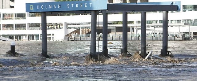
People and cities can’t survive without water. Too much water, though, can also be devastating, as communities from Atlantic City — slammed last fall by Hurricane Sandy — to China’s Kunming have been reminded recently.
With sea levels already rising and at least another four feet of increase “locked in,” according to new research, cities along coastlines and in low-lying areas are likely to be ever-more vulnerable to flooding.
So what’s an urban planner to do? Around the globe, researchers and officials are exploring a variety of options, including:
1. Make sidewalks, roads and pavements more porous.
For parts of the world, a changing climate means a greater and more frequent chance of extreme rainfall … and that means an increased potential for urban flooding.
One possible solution — being explored by the CLASS (for “Climate Adaptive Surfaces”) project at the VTT Technical Research Center of Finland — is better, more water-permeable surfacing materials. Among the Finnish cities participating in the project are Espoo, Helsinki, Oulu and Vantaa.
“These new materials can replace traditional dense asphalt, concrete and stone surfaces and reduce the accumulation of rainwater in areas such as streets and plazas,” according to the VTT.”Flooding can also be prevented by developing sub-base structures, such as aggregate, pipes, geotextiles and water storage tanks.”
2. Build “amphibious” housing.
From Peru to the Netherlands, Hong Kong to Louisiana, houseboats and living on the water have long been a way of life for some. But advances in engineering and construction could make floating lifestyles both safer and more comfortable for many more.
Louisiana’s Resiliency Assistance Program, for example, is looking to examples like the Dutch village of Maasbommel, where a small development of floating houses was completed by the construction firm Dura Vermeer in 2008. Using “adaptive building techniques,” the company designed houses that can not only float, but are protected from storms and whipped-up elements with the aid of permanent, ground-based mooring posts.
Depending on water levels, these houses can rise and fall safely — secured by the mooring posts — without being tossed about in the waves. Even the utility connections for water, sewer and electricity are flexible, ensuring each home stays linked to essential services no matter what.
3. Get better data.
Satellite imagery has revolutionized weather forecasting … yet until recently the concept hasn’t been globally applied to flood observation and alerting systems.
A mostly Dutch flood management effort, Flood Control 2015 (soon to be relaunched as “Flood Control 2100”), seeks to change that through the Global Flood Observatory (GFO), developed in cooperation with the Dartmouth Flood Observatory. Using freely available satellite data from NASA and the European Space Agency (ESA), GFO “produces (almost) real-time images of floods all over the world in a systematic and automated manner.”
Algorithms applied to satellite data make it possible to get a better-than-ever gauge of global flood risks — down to probable local water levels in any particular area — enabling officials to use the GFO interface “for daily or even more frequent flooding alarms.”
“By presenting satellite images via an interface, everybody with an internet connection can keep close track of flood events all over the world,” states the Flood Control 2015 book, “Five Years of Innovation in Flood Risk.”
When the ESA’s Sentinel-1A satellite is launched (scheduled for October 2013), the Global Flood Observatory will gain access to even better, more high-resolution data about conditions across the planet.


